

UAV Spectral Imaging Index Analyzer
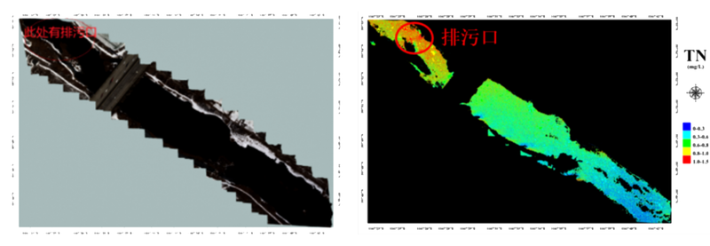
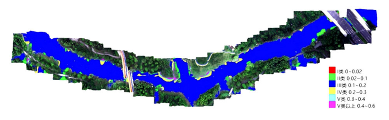
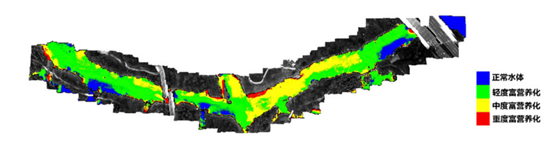
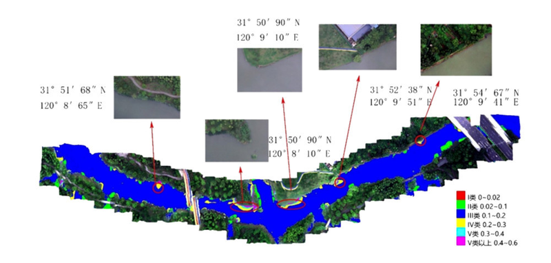
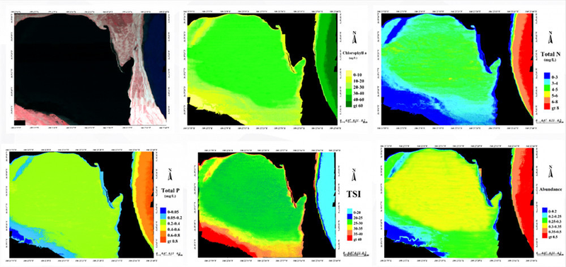
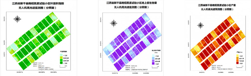
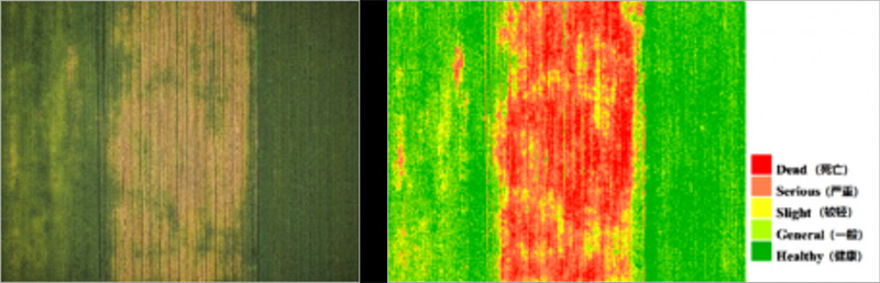
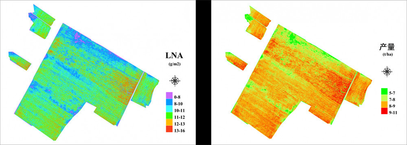
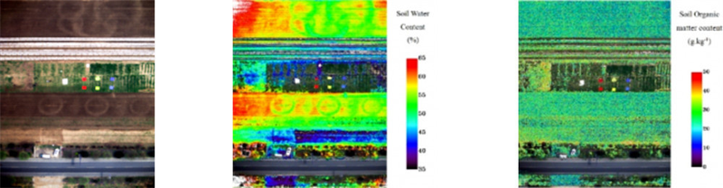
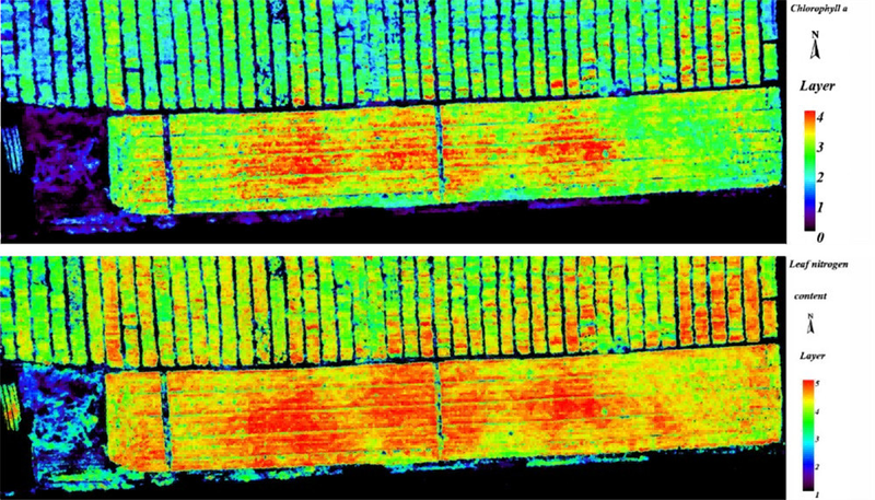
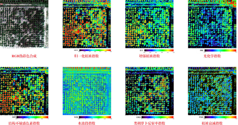
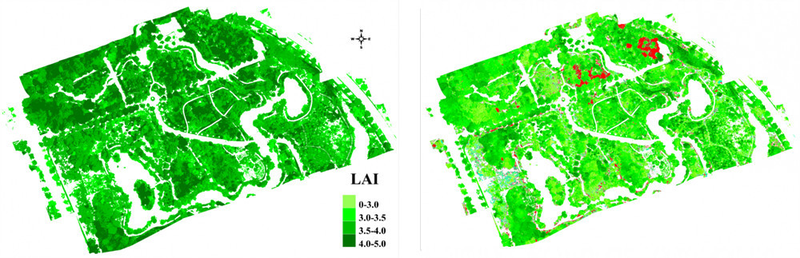
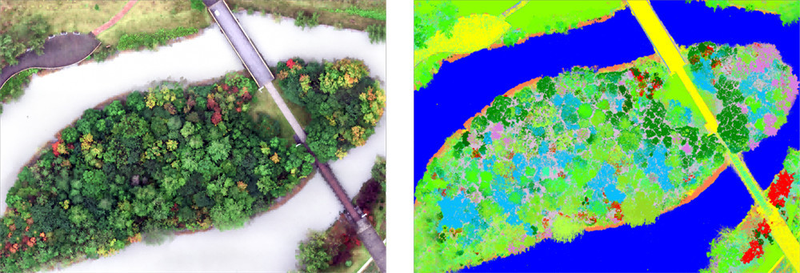
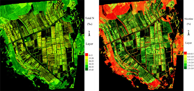
The UAV spectral-imaging index analyzer provides real-time monitoring of rivers and lakes, agriculture, forests, and grasslands. Water applications include pollution monitoring, suspected-source investigation, aquatic ecological-disaster monitoring, shoreline surveys, and black/odorous-water remediation. Agricultural applications include planting assessment, crop growth and lodging monitoring, variable-rate crop-protection spraying, and yield estimation. Forestry and grassland applications include tree physical/chemical and structural parameters, water/fertilizer stress, pests and diseases, forage yield, coverage, disasters, degradation, and nutrition. A single map supplies firsthand information and technical support. Water monitoring gives real-time spatial distributions of more than20 indicators, including total nitrogen, total phosphorus, chlorophyll a, suspended matter, permanganate index, algae distribution, and eutrophication index, enabling efficient online analysis. Agricultural monitoring maps crop growth, lodging, and yield in real time to inform field operations and intelligent management. Forest and grassland monitoring similarly maps growth, physical/chemical parameters, and yield for intelligent management. The source describes China as a leading tobacco grower, with cultivation throughout its provinces, the world's largest area and output, and substantial tax and economic contributions. Flue-cured tobacco represents more than80% of production and is the principal cigarette raw material. Traditional monitoring of tobacco growth and quality is time-consuming, labor-intensive, and costly. UAV spectral imaging rapidly and accurately surveys large areas, providing data for fertilization, irrigation, and pesticide spraying. It supports modernization of pesticide practices and sustainable modern agriculture, giving it substantial value and making it a new trend in tobacco-field management.
 Save to Favorites
Overview
Specifications
| Parameter | Value |
|---|---|
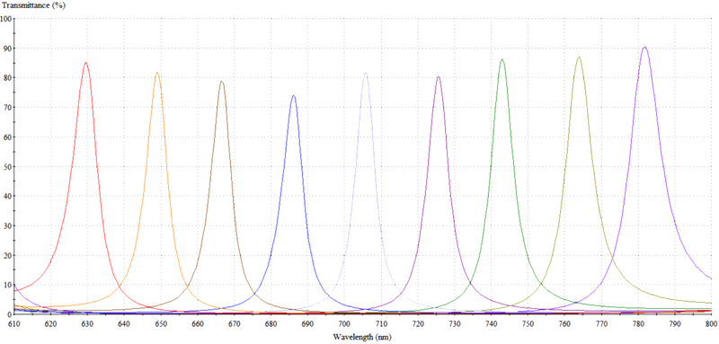
| Spectral Range [Default Dual-Camera Range; Customization Supported] | 460-570nm + 640-785nm (Default Dual-Camera Range;Customizable) |
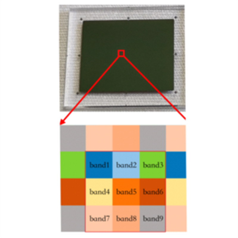
| Number of Spectral Channels [Single Camera] | 9 |
| Number of Spectral Channels [Dual Cameras] | 18 |
| Spectral Resolution | ≤12nm |
| Exposure Time | 28μs-1s |
| Image Resolution | 1020×1020 |
| Lens Field of View [Diagonal] | 36°( Diagonal ) |
| Lens Focal Length | 25mm |
| Lens Aperture | F/4 |
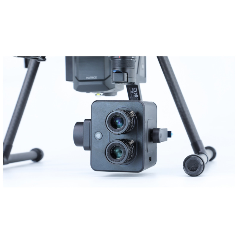
| Compatible UAV [Other Models Customizable] | DJI M210 & M300 (Other Models Customizable) |
| Compatible Gimbal | Dji Xport |
| Dimensions (Length × Width × Height) [Excluding Lens] | 85×80×100mm( Excluding Lens ) |
| Weight [Gimbal Excluded] | 550g (Gimbal Excluded) |
| Embedded Computer Interfaces | USB3.0 + HDMI |
| Storage Device | Embedded Micro SD Card,Default64G,Supports up to128G |
| Minimum Working Distance | 20m |
| Voltage | 13.6v |
| Power Consumption | 20W |
| POS Data | Xport GPS Data |
| Spectral Image Acquisition Rate [Without Real-Time Model Calculation] | 1:45fps |
| Spectral Image Acquisition Rate [Real-Time Model Calculation] | 1~15S/组 |
| Image Storage Format | 10bit RAW + HDR;Spectral Images + Index Results |
| Indices Available for Real-Time Inversion | 25 Vegetation Indices Including NDVI,EVI,NDVI705,SAVI,RVI,and Online Models for Multiple Water Indicators |
Applications
Datasheet
Supplier Information
Related Products
-
Aurora 900 structured-light depth camera Scientific & Industrial Cameras Deptrum
Overall System Dimensions [Without mounting wings]: 61mm*18mm*13.5mm Baseline: 40mm Interface: USB 2.0 Wafer receptacle interface
The Deptrum® Aurora 900 is a compact, low-power, high-performance 3D structured-light depth camera. High-performance depth ASIC, ISP, and AI modules support Face AE and high-quality color, infrared, and depth images across lighting conditions. A built-in encryption chip digitally signs images to prevent tampering. The Aurora 900 has WeChat Pay and BCTC certification for WeChat and UnionPay facial payments, as well as door locks, access control, volume measurement, and other uses.
-
Aurora 910 depth camera Scientific & Industrial Cameras Deptrum
Overall System Dimensions [Without mounting wings]: 61mm*18mm*13.5mm Baseline: 40mm Interface: USB 2.0 Wafer receptacle interface
Based on speckle structured light, an in-house 3D structured-light depth soft-core reconstruction algorithm captures three-dimensional object and spatial structures. Fusing camera RGB images with depth data provides convenient, efficient 3D perception. Depth HDR and closed-loop RGB/IR Face AE provide high-quality facial images at 100000Lux. Deptrum's BCTC enhanced-level facial-liveness solution provides a complete offering for facial payment, access control, and subway passage.
-
Aurora 930 depth camera Scientific & Industrial Cameras Deptrum
Overall System Dimensions [Without mounting wings]: 61mm*18mm*14.3mm Baseline: 40mm Interface: USB 2.0 Wafer receptacle interface
The Deptrum® Aurora 930 depth camera uses 3D structured light to capture object and spatial structures. High-performance ISP and ASIC depth-processing chips output high-quality color, infrared, and depth images over 3-80,000Lux, maintaining quality under low light, backlighting, and other difficult conditions. Applications include robot obstacle avoidance and volume measurement.
-
HandPass 100 dual-modality camera Scientific & Industrial Cameras Deptrum
Complete-unit diameter: 85.39mm Complete-unit thickness: 19.9mm Baseline: 14mm
The Deptrum® HandPass 100 dual-modal palm-recognition camera combines precision optics, high-performance ISP and AI modules, and a soft-core AE algorithm for fast palm detection and self-closed-loop Palm AE. It provides high-quality palmprint and palm-vein images in low light, backlighting, and other conditions. A built-in encryption chip signs images to prevent tampering and protect payment data. Applications include palm-recognition access control, subway gates, smart buildings, and offline payment.
-
Libra 1000 depth camera Scientific & Industrial Cameras Deptrum
Module dimensions: 38.9 mm × 42 mm × 22.24 mm Baseline: 2cm Interface: GMSL 2.0 Fakra interface
The Libra 1000 depth-camera series uses binocular 3D imaging to capture object and spatial structures. A high-performance ISP and image-processing engine output preprocessed binocular images. Combined with a high-performance depth-reconstruction SDK, it enables robots to reconstruct binocular depth with ultrahigh precision at close range.
Related Articles
As a top‑tier supplier of tunable laser chips, Shandong Zhongxin Optoelectronics Technology Company has newly launched the world’s first budget‑friendly fiber‑Bragg‑grating (FBG) demodulator and scanning module.
Recently, the key laboratory of Functional Crystal Materials of Tianjin University has published a cutting-edge research paper titled Enhanced Second-Harmonic Generation in Quadratically Nonlinear Weyl Semimetal NbAs for Broadband Photodetection Applications on Advanced Science, a top-tier international academic journal.
Recently, our R&D crew carried‑out performance tests on domestically‑made third‑party LiDAR hardware. The original built‑in sensor chip was replaced by Optics‑Valley Quantum’s new‑generation D‑XXLA200‑02 chip.
The accelerated construction of new‑generation power systems has brought revolutionary upgrades to power‑equipment maintenance workflows.
Loading...
Name
Phone
Organization
Use Case

Database Platform