HITRONICS LiDAR Solutions for Low-Altitude Aircraft
Published: 2026-08-18 15:19:21 Views: 72
As a vital emerging sector of modern three-dimensional spatial economy, the low-altitude economy has become a new global growth driver. It covers a wide range of commercial scenarios, including UAV navigation and obstacle avoidance, precise airspace management, aerial mapping, low-altitude logistics distribution, security monitoring and emergency disaster rescue. Nevertheless, frequent extreme weather, complex terrain obstacles and increasingly dense low-altitude flight activities pose severe challenges to the safety and stability of low-altitude aircraft operations.
Safety acts as the cornerstone for the large-scale development of the low-altitude economy. As a high-precision 3D perception device, LiDAR serves as the core technical guarantee for safe low-altitude flight. According to industry experts at the 27th Annual Conference of the China Association for Science and Technology, advanced LiDAR technology enables full-area remote sensing identification and short-term early warning of meteorological disasters, accurately predicting weather risks within one hour for flight route optimization and risk avoidance.
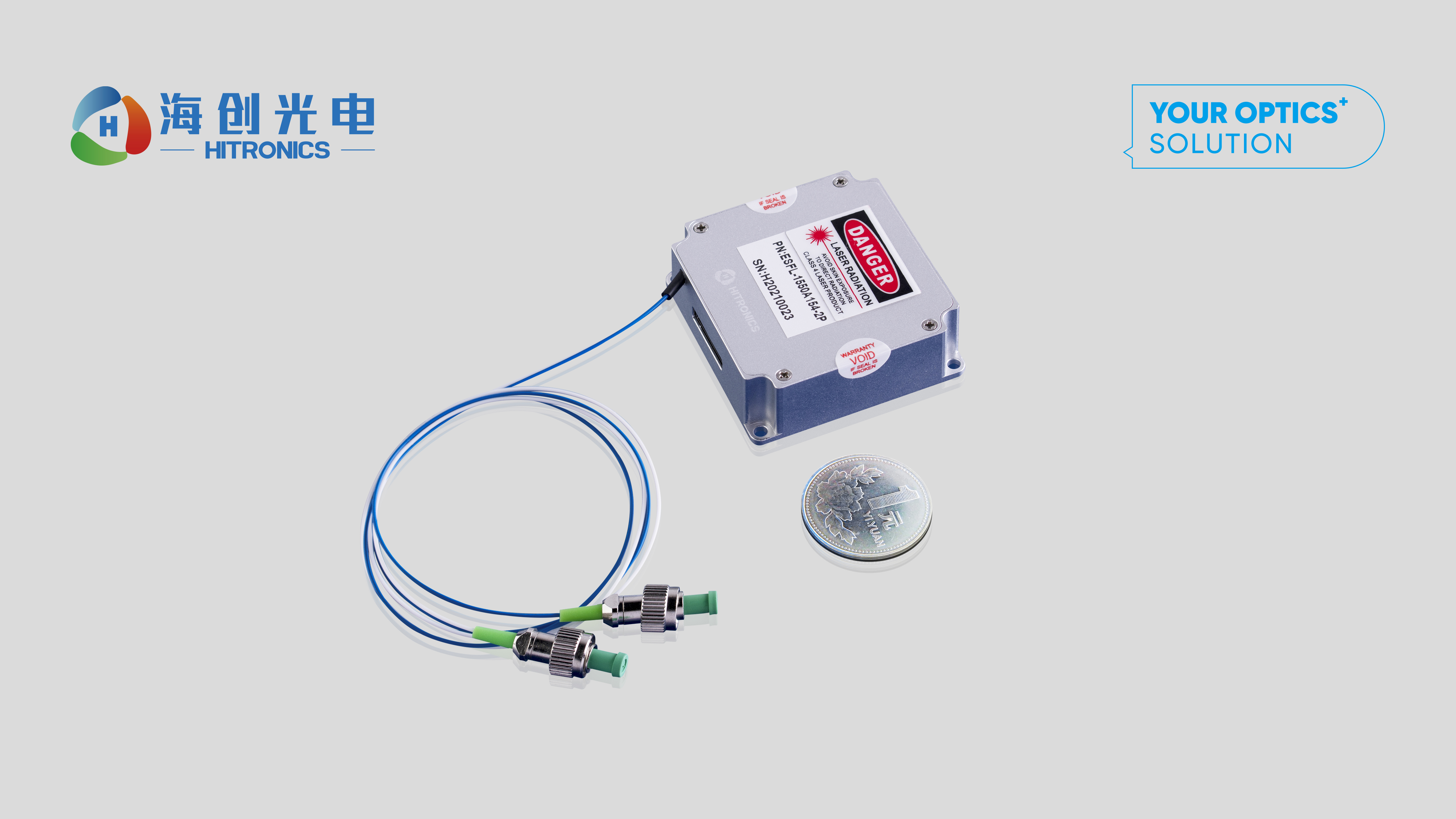
Featuring high precision, ultra-high resolution and omnidirectional 3D imaging capabilities, LiDAR has become an indispensable core technology empowering the iterative upgrading of the low-altitude economy. HITRONICS deeply focuses on low-altitude perception scenarios and independently developed the 1550nm LiDAR light source module. As the world’s first mass-produced high-end LiDAR transmitter with ultra-miniature size and ultra-low power consumption, it leads the industry in comprehensive performance and industrialization capability.
Adopting automotive-grade derating and redundant design, the module delivers exceptional operational reliability suitable for harsh and complex low-altitude working environments. With self-developed integrated optical components and professional fiber winding technology, it achieves compact size and low power consumption without sacrificing detection performance. Optimized with domestic industrial chain advantages, the innovative structural design effectively reduces the high cost proportion of traditional LiDAR light sources, realizing excellent cost performance and scalable mass production.
Equipped with long detection range, high ranging accuracy, fast response speed and strong anti-light interference capability, the lightweight miniaturized module supports the integration of airborne, vehicle-mounted and satellite-borne LiDAR systems. It is widely applied in urban 3D modeling, smart city construction, topographic mapping, engineering monitoring, forest resource survey, disaster assessment, high-precision mapping for autonomous driving, cultural heritage archaeology, power energy inspection and precision agriculture, providing solid optoelectronic perception support for diverse intelligent industries and low-altitude economic applications.